

Deforestation inside Kutai National Park in East Kalimantan
Deforestation plagues the park inhabited by Bornean orangutans and proboscis monkeys.
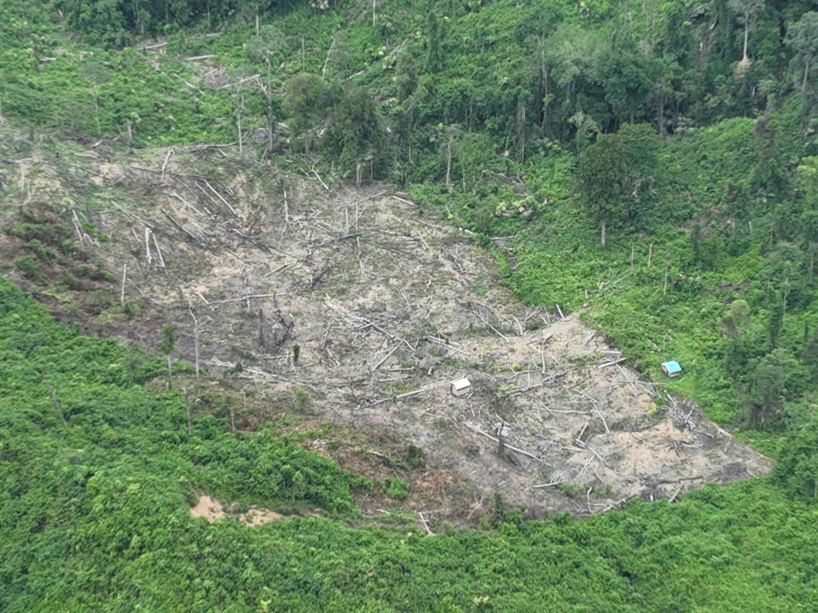
A deforested area inside Kutai National Park recorded at coordinates 0°21'25.95"N, 117°27'55.668"E. Photo: Auriga Nusantara, 5 May 2026.
Forests inside national parks should be the safest in Indonesia in terms of deforestation. In addition to being strictly protected
by legislation through both conservation and forestry Law, national parks also have dedicated management units, namely National Park Offices, which are directly responsible to the Director General of Natural Resources and Ecosystem Conservation under the Ministry of Forestry.
However, this does not seem to be the case in East Kalimantan’s Kutai National Park, as evidenced by the following images taken during ground truthing activities in May 2026.
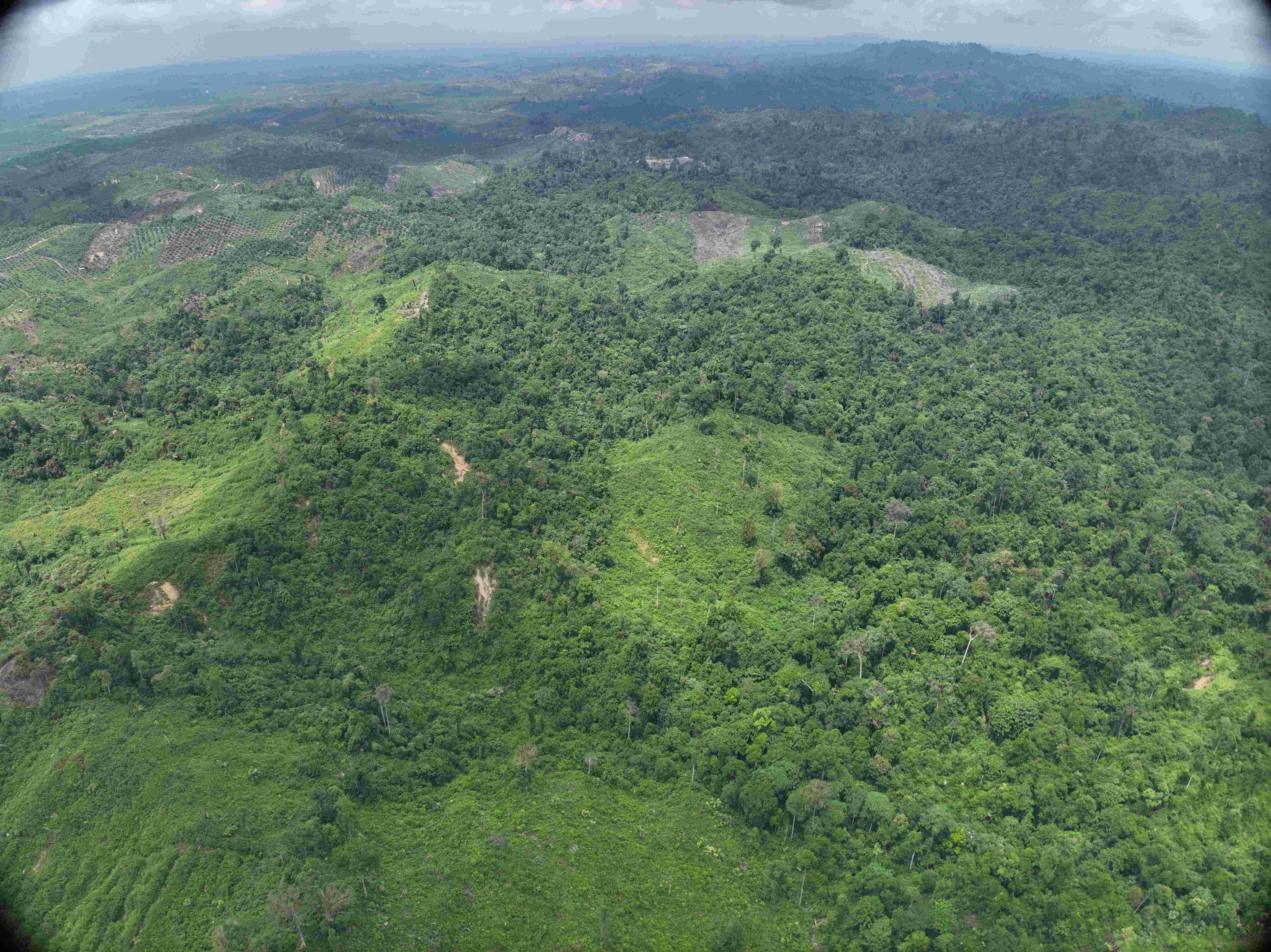
Deforested patches inside Kutai National Park, recorded at coordinates 0°21'25,956"N, 117°27'55.686"E. Photo: Auriga Nusantara, 5 May 2026.
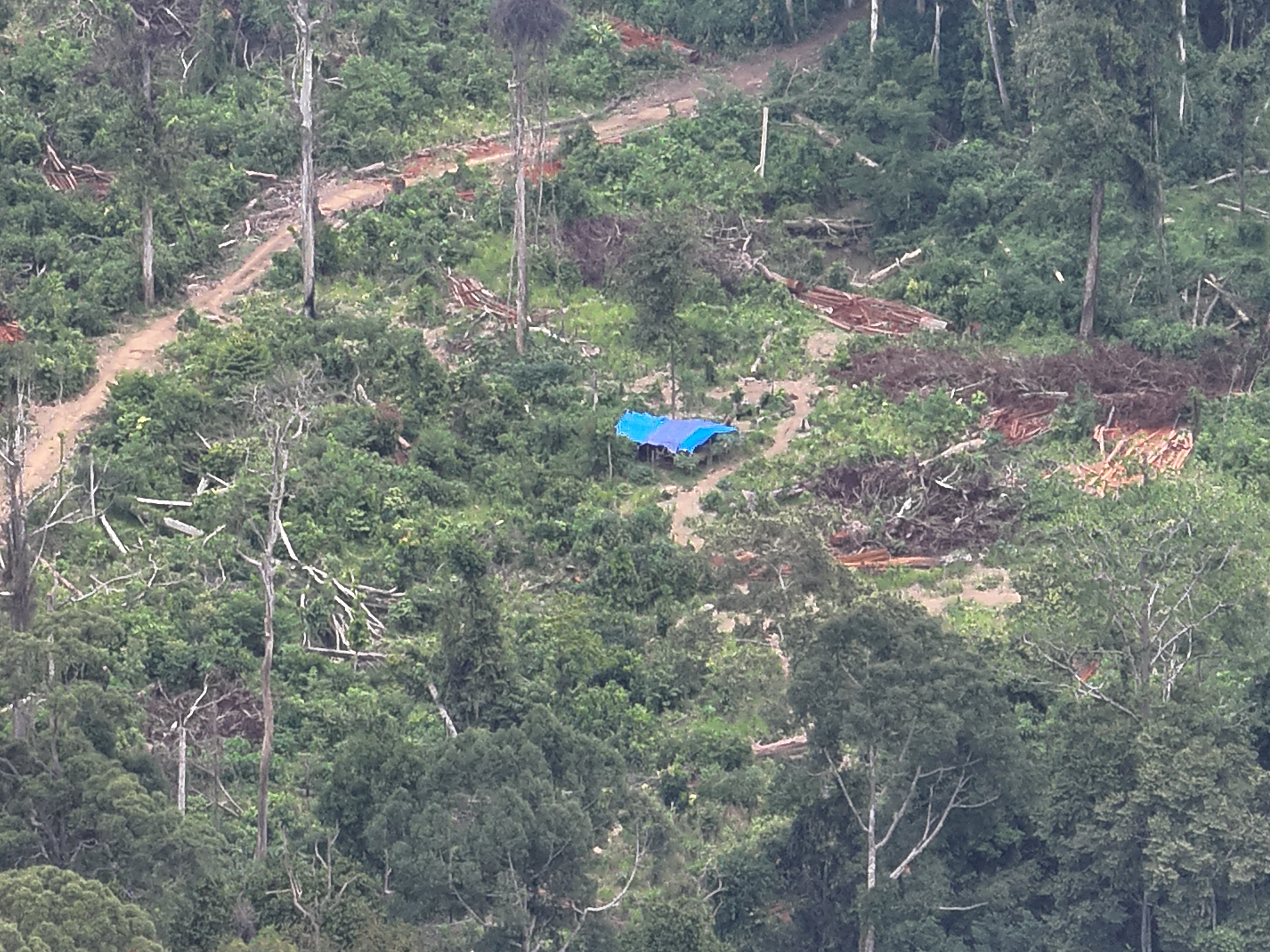
An illegal loggers’ shelter alongside sawn timer inside Kutai National Park, recorded at coordinates 0°21'25,944"N, 117°27'55.686"E. Photo: Auriga Nusantara, 5 May 2026.
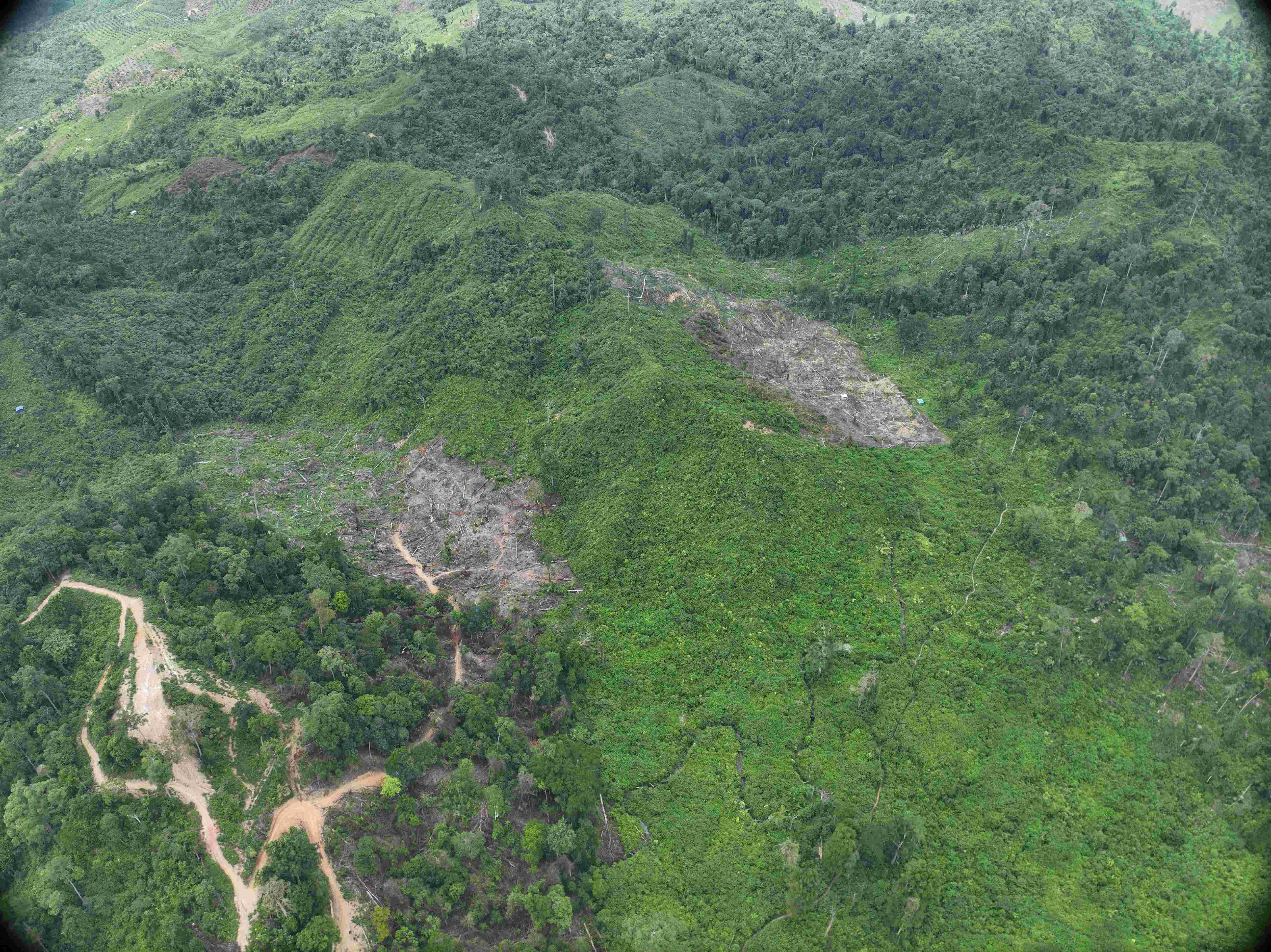
Deforested patches inside Kutai National Park, recorded at coordinates 0°21'25,956"N, 117°27'55.686"E. Photo: Auriga Nusantara, 5 May 2026.
Kutai National Park, designated in 1995, covers an area of 192,583 hectares. It is home to endangered species, such as the Bornean orangutan (Pongo pygmaeus), proboscis monkey (Nasalis larvatus) and sun bear (Helarctos malayanus). Kutai National Park is managed by the Kutai National Park Office, which has 92 employees and an operational budget (as of 2025) of IDR 16.8 billion.
Based on land-cover data presented on the MapBiomas Indonesia platform, in 1996 the area of natural forest in Kutai National Park was 151,295 hectares (78.6%). This area had decreased to 130,867 hectares (68%) by 2000, and then to 129,389 hectares (67.2%) in 2024.
Changes in land cover in Kutai National Park from 1990–2024 show the forest shrinking due to conversion across almost the entire area, resulting in fragmentation. Source: MapBiomas Indonesia Collection 4.
| bulan | hektare |
|---|---|
| Jan | 43 |
| Feb | 10 |
| Mar | 48 |
| Apr | 11 |
| Mei | 27 |
Spatial analysis of Sentinel satellite imagery indicates 139 hectares of deforestation occurring inside Kutai National Park from January–May 2026.
CITATION
Deforestation inside Kutai National Park in East Kalimantan, accessed on [DD/MM/YYYY] via the link [LINK]. Auriga Nusantara. 2026
© Auriga Nusantara. 2026.
Follow the latest developments in this story
Receive email notifications of the latest updates.
Discussion
Comments
0 comments
No comments yet.