

Deforestation and the loss of natural ecosystem by the Merauke Food Estate
This giant food and energy estate project not only threatens natural forest, but other natural ecosystems as well.
Rice fields and other intensive agricultural crops inside the Merauke Food Estate National Strategic Project (PSN) area established through the conversion of natural forest and other natural ecosystems. Recorded at coordinates 140°35′17.80″E, 8°16′53.27″S. Photo: Auriga Nusantara, 6 May 2026.
The Merauke landscape provides a clear demonstration of the Indonesia's inappropriate reference framework for managing natural ecosystems, which tends to be based on conditions in Western Indonesia. This inappropriate nature is evident in at least three respects.
First, the scoring system for determining protected areas, particularly protected forests, places strong emphasis on slope gradient. Being an extremely flat region has resulted in only 0.05 percent of Merauke Regency’s 4.7 million hectares of land being being protection forest.
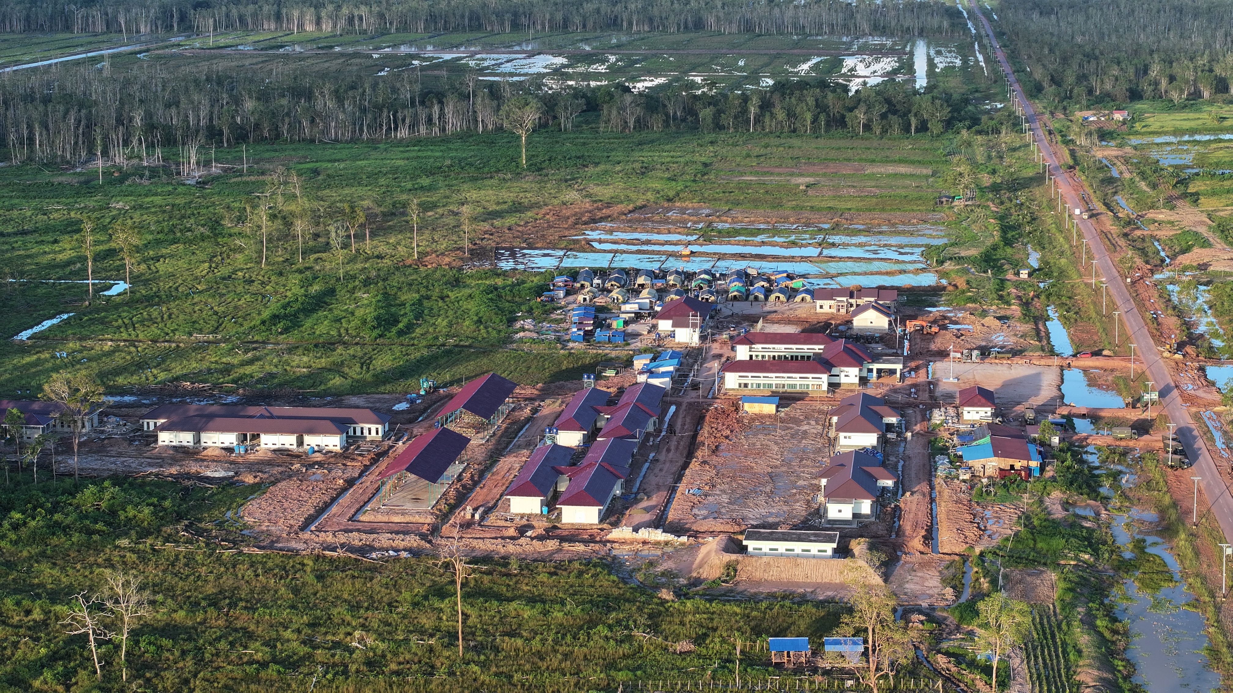
The Yonif TP 818/Yuboi Territorial Development Infantry Battalion base in Sermayam Indah Village, Jagebob District, Merauke Regency, Southwest Papua. It is considered an agricultural battalion because, in addition to being established inside an agriculture area, the battalion is also the implementer of the Merauke Food Estate National Strategic Project, as recorded at coordinates 140°35'58.60"E, 8°16'58.11"S. Photo: Auriga Nusantara, 6 April 2026.
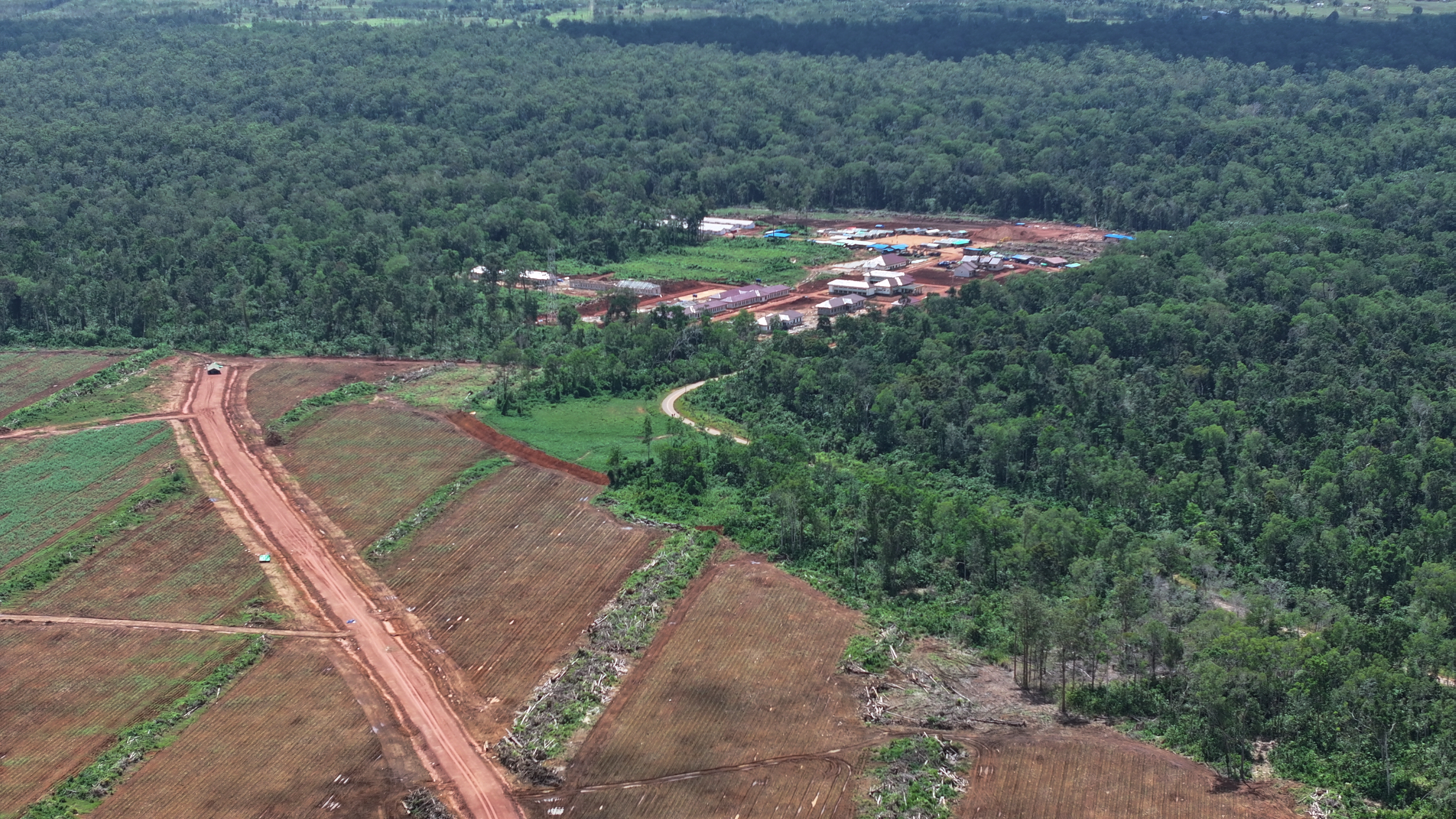
Deforestation and conversion of natural ecosystems for sugarcane plantations to supply a bioethanol plant near Yonif TP 817/Aoba in Jagebob District, Merauke Regency, as recorded at coordinates 140°45'1.75"E, 7°54'21.03"S. Photo: Auriga Nusantara, 6 May 2026.
Second, one of the main criteria for determining whether land is degraded is forest stand volume. Given the region’s unique character, it is extremely hard to find large-diameter trees in the climax wetland ecosystems of Merauke. As a result, such areas are considered critical land in need of “increased” timber volumes, either through monoculture timber stands or conversion to “productive agricultural land”.
Third, food parameters are dominated by rice. Whereas staple foods for Indigenous Papuans are not rice, but various foods sourced from the forests around them, especially sago and tubers.
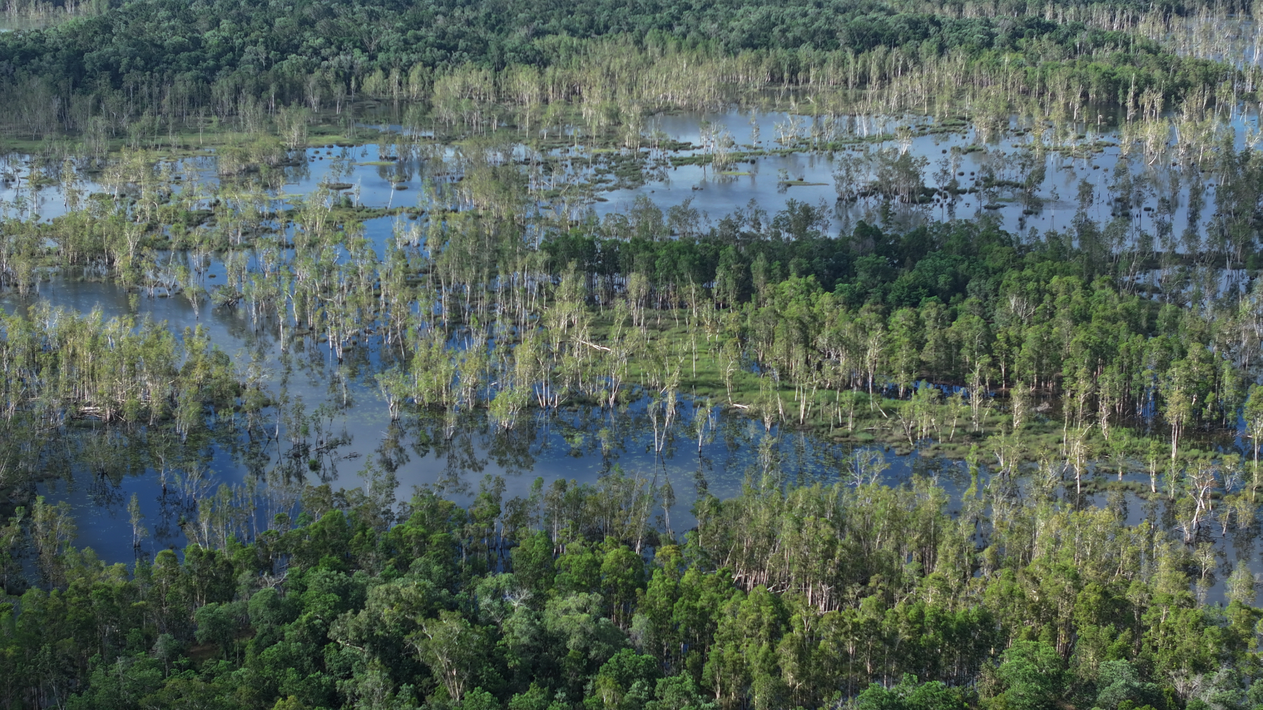
A natural wetland ecosystem inside the Merauke Food Estate area, recorded at coordinates 140°45'34.41"E, 8°7'1.62"S. Photo: Auriga Nusantara, 6 May 2026.
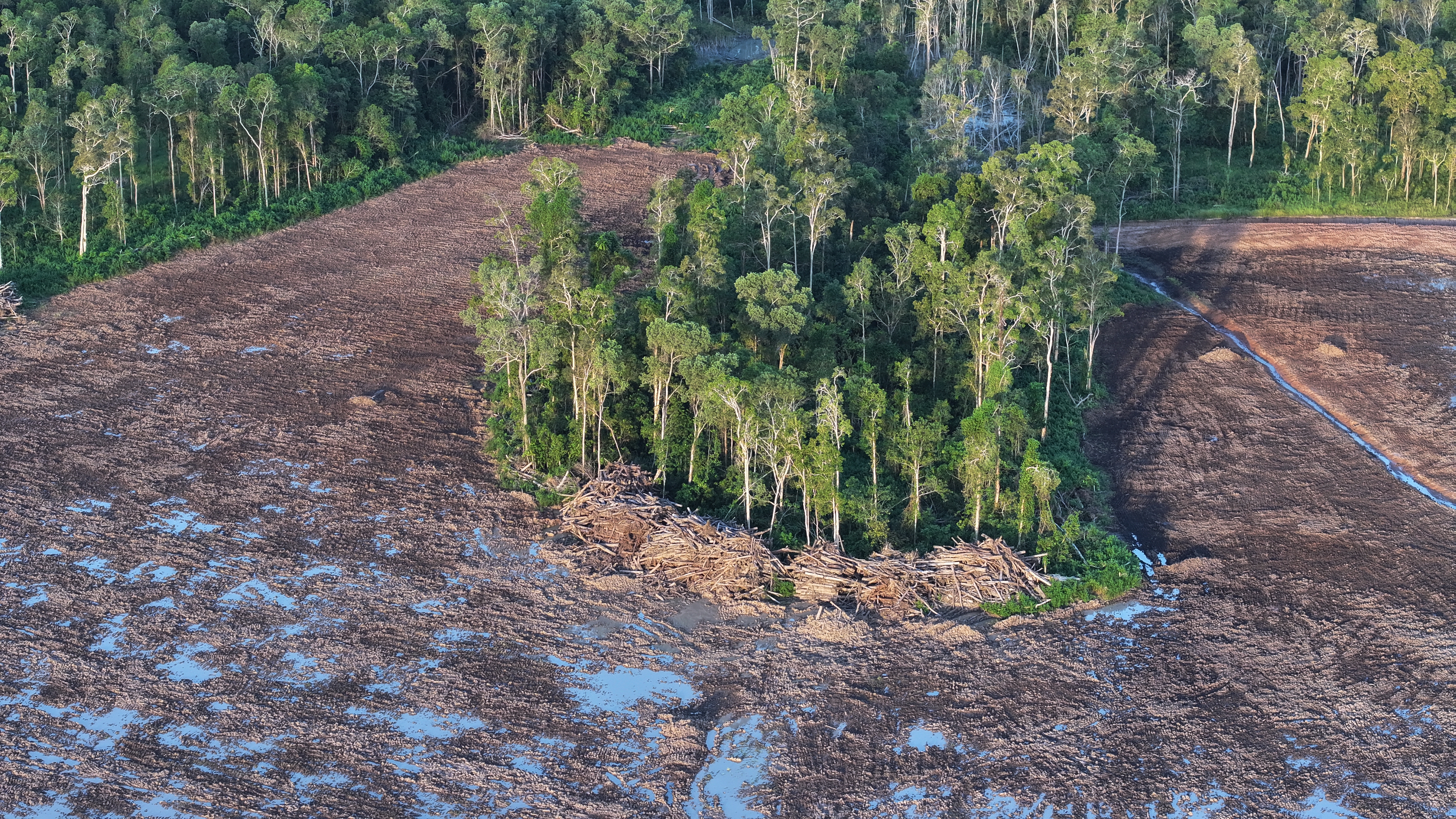
Clearing of a natural ecosystem dominated by relatively small-diameter Melaleuca sp. inside the Merauke Food Estate area, recorded at coordinates 140°35'37.82"E, 8°16'35.09"S. Photo: Auriga Nusantara, 5 May 2026.
The Merauke Food Estate is part of a chain of outcomes. Natural ecosystems have been slated for conversion to monocultures on an enormous scale with introduced species like wetland rice, sugarcane, and others on an area of 2.2 million hectares. Its enormity has led to Mongabay referring to it as the world’s biggest deforestation project.
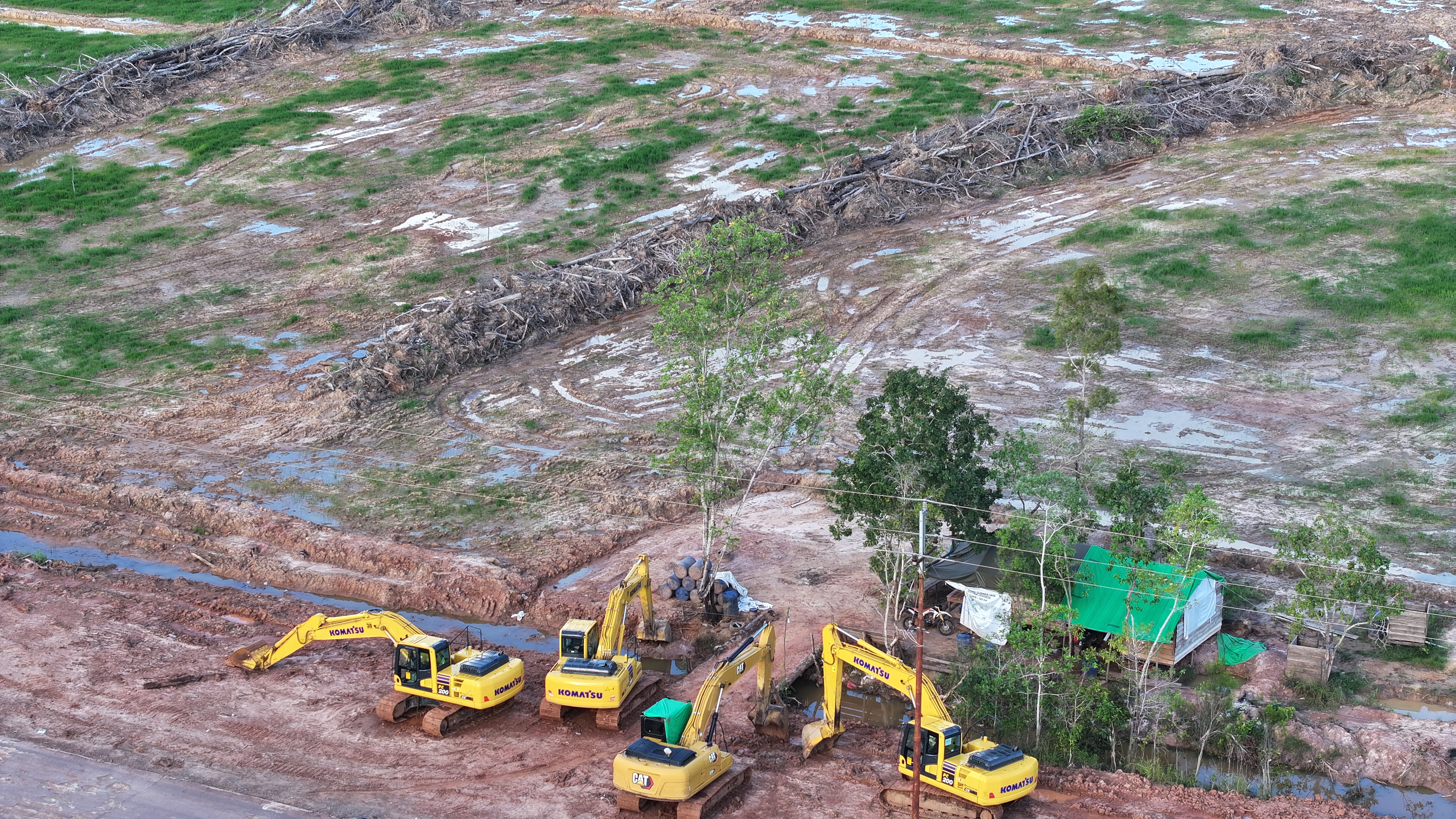
An excavator clearing land inside the Merauke Food Estate area, recorded at coordinates 140°45'25.62"E, 8°12'37.87"S. Photo: Auriga Nusantara, 5 May 2026.
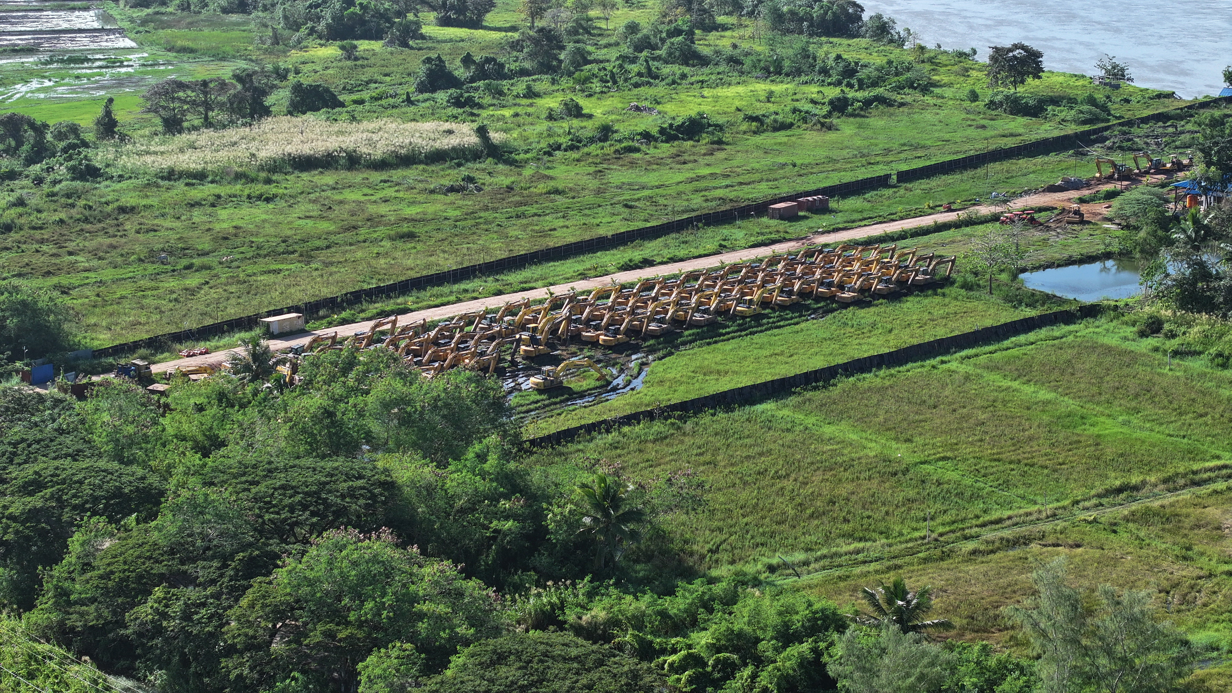
Dozens of excavators for cutting down forest and natural ecosystems and clearing land inside the Merauke Food Estate area, recorded at coordinates 140°22'42.98"E, 8°26'10.47"S. Photo: Auriga Nusantara, 7 May 2026.
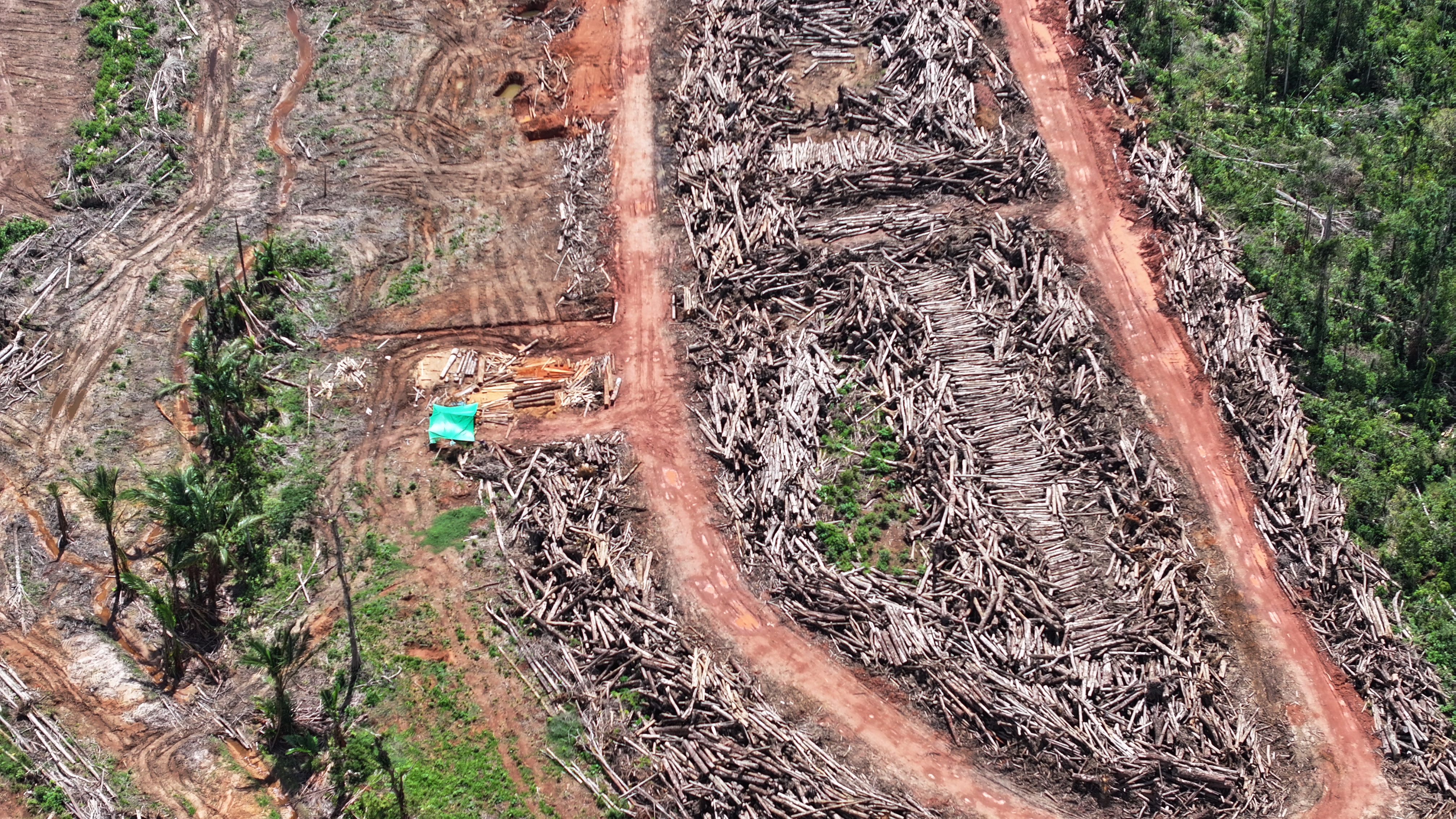
Timber stacked up after clearing forests and natural ecosystems inside the Merauke Food Estate area. The area slated for planting sugarcane was recorded at coordinates 140°45'30.26"E, 7°54'51.96"S. Photo: Auriga Nusantara, 6 May 2026.
Merauke Food Estate is the current name of the food project in Merauke, South Papua, established as a National Strategic Project (PSN) by the Joko Widodo administration on 10 November 2023. Part of the area had already been allocated for a food and energy project during the Susilo Bambang Yudhoyono era. In 2007, the area was declared a pilot project site for the large-scale industrial rice farming project called the Merauke Integrated Rice Estate (MIRE) and implemented by the Medco Group. In August 2010, it subsequently became the Merauke Integrated Food and Energy Estate (MIFEE).
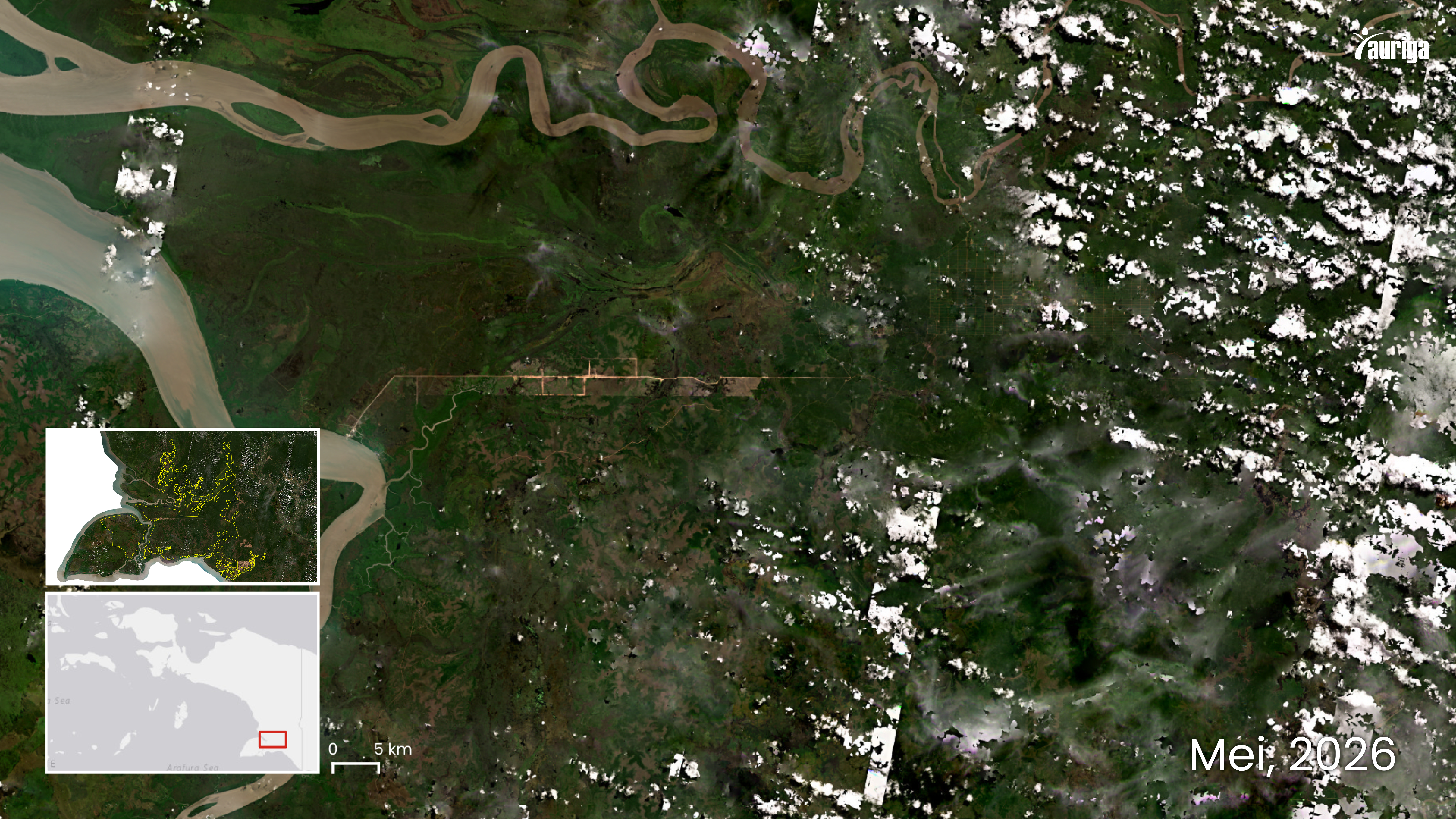
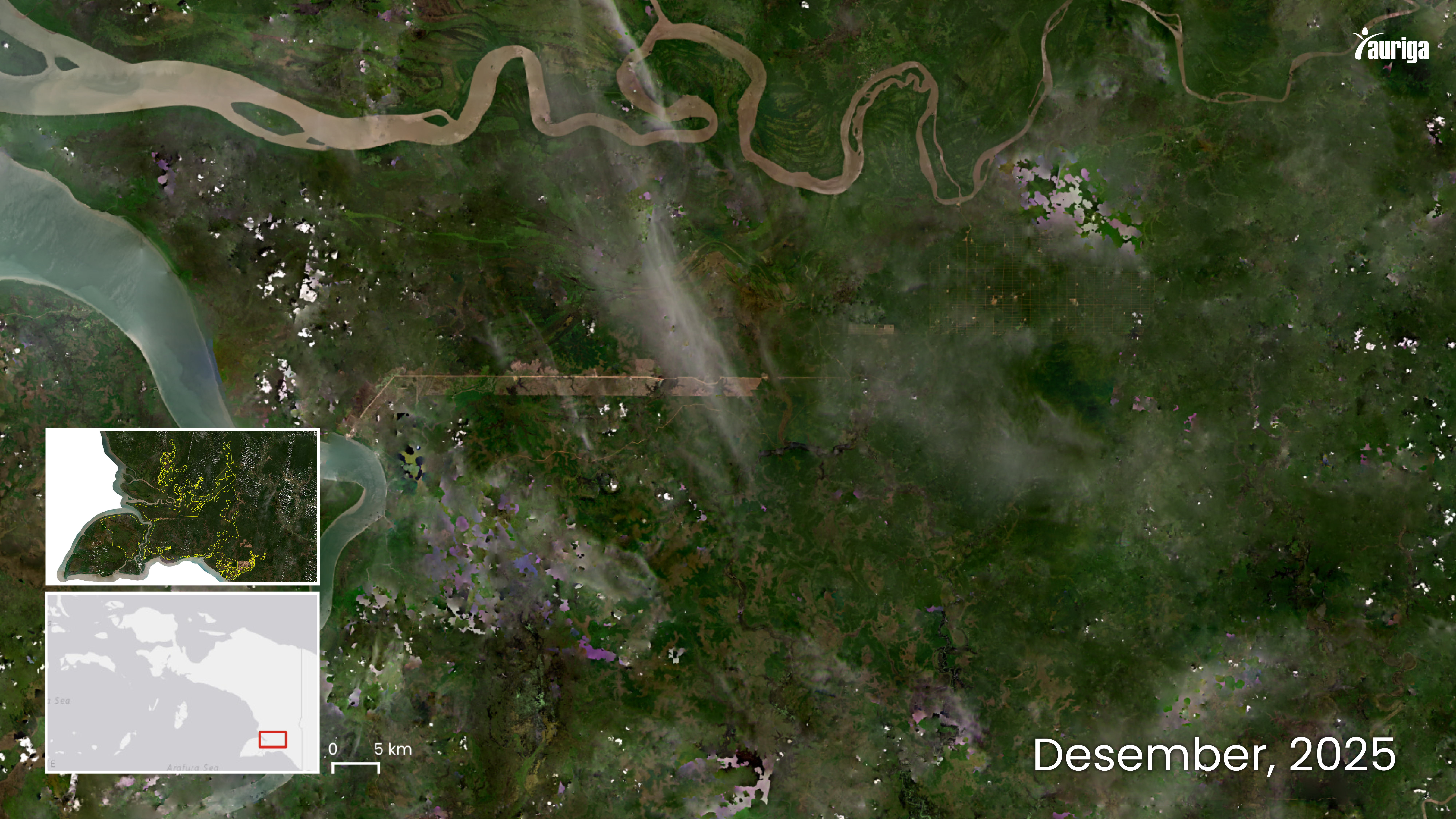
Land cover changes resulting from land clearing inside the Merauke Food Estate area. Cleared areas are along, or preceded by the construction of roads. Identified since August 2024, a total of 12,048 hectares had been cleared by July 2026. Source: Planet Scope
Auriga Nusantara’s searches of Merauke Food Estate maps found the estate covers an area 2.2 million hectares. Since its November 2023 designation as a National Strategic Project (PSN), more than 11,000 hectares of Merauke's forests and natural ecosystems have been cleared; 4,603 hectares in 2024 and 6,605 hectares in 2025.
| Bulan | Nilai |
|---|---|
| Jan | 148 |
| Feb | 403 |
| Mar | 561 |
| Apr | 264 |
| May | 62 |
This land clearing resulted in the loss or deforestation of 2,892 hectares of natural forest; 269 hectares in 2024 and 2,623 hectares in 2025. As the graph above shows, deforestation – and the loss of natural ecosystems – will continue, not only because the project is protected by government policy (legal deforestation), but also because natural ecosystems such as savannas have no legal protection in Indonesia.
CITATION:
Deforestation and the loss of natural ecosystem by the Merauke Food Estate, accessed on [DD/MM/YYYY] via the link [LINK]. Auriga Nusantara. 2026
Follow the latest developments in this story
Receive email notifications of the latest updates.
Discussion
Comments
0 comments
No comments yet.